


Les hauteurs de La ripelle - Le revest Les eaux

affinetataille
User GUIDE
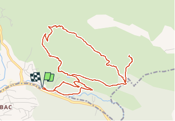

Length
7 km

Max alt
373 m

Uphill gradient
362 m
Km-Effort
11.8 km

Min alt
96 m

Downhill gradient
365 m
Boucle
Yes
Creation date :
2020-12-07 13:00:42.815
Updated on :
2020-12-07 20:45:39.88
2h49
Difficulty : Difficult

FREE GPS app for hiking
 SityTrail
IGN / Geographical institutes
SityTrail Plus
The world is yours!
About
Trail Walking of 7 km to be discovered at Provence-Alpes-Côte d'Azur, Var, Le Revest-les-Eaux. This trail is proposed by affinetataille.
Description
Quelques passages difficiles dans des éboulis sous la barre rocheuse
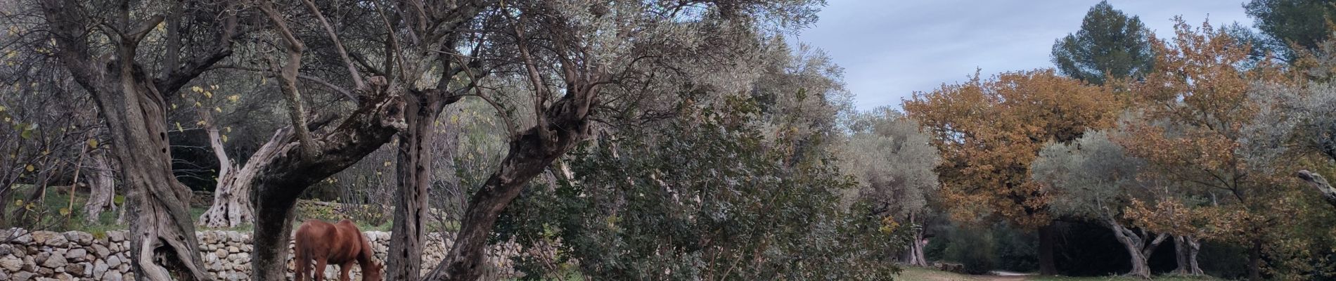
Photos


Positioning
Country:
France
Region :
Provence-Alpes-Côte d'Azur
Department/Province :
Var
Municipality :
Le Revest-les-Eaux
Location:
Unknown
Start:(Dec)
Start:(UTM)
739062 ; 4783316 (31T) N.
Comments